


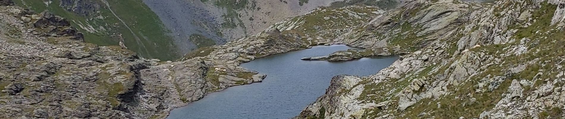
du refuge du Grand plan à Mottaret

bymarc26
User
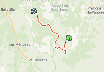

Length
15.5 km

Max alt
2903 m

Uphill gradient
408 m
Km-Effort
24 km

Min alt
1684 m

Downhill gradient
1243 m
Boucle
No
Creation date :
2023-08-10 08:32:55.31
Updated on :
2023-08-10 15:47:07.22
4h35
Difficulty : Very difficult

FREE GPS app for hiking
 SityTrail
IGN / Geographical institutes
SityTrail Plus
The world is yours!
About
Trail Walking of 15.5 km to be discovered at Auvergne-Rhône-Alpes, Savoy, Les Allues. This trail is proposed by bymarc26.
Description
oublié de démarrer le gps
passage par col de Chantougr
dénivelé réel 913 et 1482-
temps 8h
Photos


Positioning
Country:
France
Region :
Auvergne-Rhône-Alpes
Department/Province :
Savoy
Municipality :
Les Allues
Location:
Unknown
Start:(Dec)
Start:(UTM)
315657 ; 5021696 (32T) N.
Comments